HuntStand is comprehensive hunting and land management software. Users may obtain navigation, mapping, land management, reporting, weather, solunar phases, social networking, and collaboration features. HuntStand’s tools and maps cover a wide range of topics. HuntStand’s free version includes many of the app’s features, while its Pro version gives access to even more.
Maps
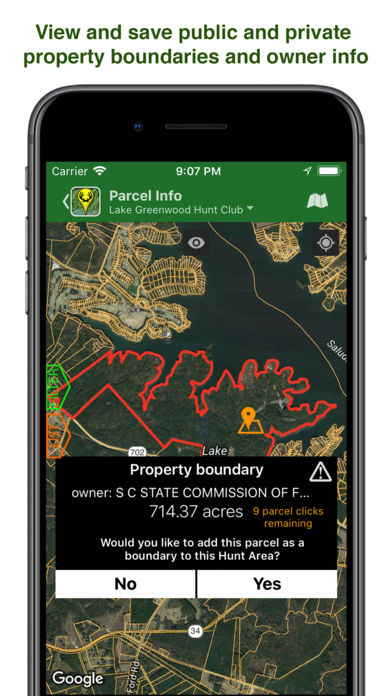
HuntStand, a TerraStride subsidiary, helps land brokers and real estate agents find the ideal parcel with TerraStride mapping technology. The app uses satellite imagery and public data to create detailed maps of public and private land.
We were blown away by the accuracy of the data. It integrates a whole array of public information, including parcel data, WMAs, DNR boundaries, GMUs, conservation areas, hydrography, topography, and much more, so you don’t need to download multiple apps or clutter your feed with various web pages.
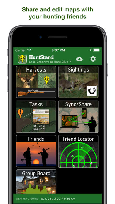
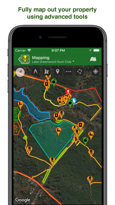
Hunting Area
The HuntStand app has one of the first features we explored: the “Create A Hunt Area” tool. This tool allows users to virtual measure, survey, and mark hunting areas in every corner of the world. Every hunting area you create is saved as a separate map. With HuntStand, you can customize your hunting area maps using various tools. You can add food plots and area boundaries with a button.
The Trace tool in the map editor is one of the most remarkable functions. This tool allows you to generate a path based on your location and movements. This feature helps you keep track of your route while recording in the background using the hide function. This feature could be used as a safety net when navigating unknown lands.
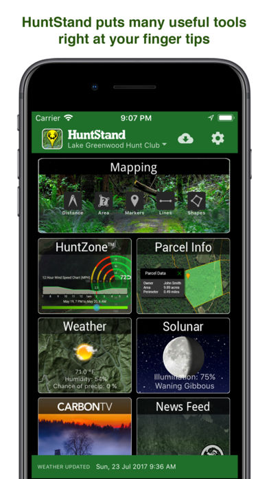
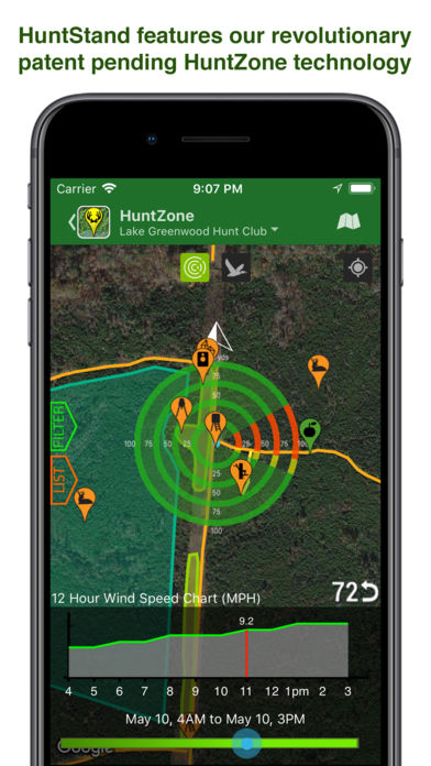
Huntzone
Huntzone is the second instrument accessible on the HuntStand app. This proprietary function allows users to keep track of the wind’s current and forecasted velocity and direction. Using this data, hunters may position themselves and their odors so that animals are not warned of their presence.
Advanced Mapping
HuntStand’s advanced mapping layers are like candy for backwood adventurers. You can input an address or location point to locate nearby hunting grounds, trails, public access routes, conservation easements, and more. You can distinguish between public and private conservation easements, state fish and wildlife conservation easements, and other conservation easements using HuntStand’s layers. We did not come across any data inconsistencies when using HuntStand.
This mapping technology uses satellite imagery and physics-guided calculations to provide a bird’s-eye view of any location. Survivalists and hunters alike may benefit from Terra Cover. Treestands, blinds, and shelters can be set up using this information.
Land Management
Landowners can take charge of and even showcase their assets with HuntStand. You may easily add hunting blinds, trail cameras, and other points of interest to your custom property map. The extensive list of pineapple icons allows you to create a thorough property database. With much of the data being measurable, there is no limit to how far a diligent mapmaker might go.
Reports
HuntStand has a wide variety of reporting tools. You can use HuntStand to record your game sightings. You can input the date and time you saw an animal and the animal you saw. All of your sightings are recorded on a saved sighting list. Users can use this data to draw significant conclusions about game activity in their area. This part of the app combines all your custom mapping information and inputs and generates concisely graphed data on harvests and sightings.
HuntStand Media
We also like that anyone can see this app’s blog and “Media” section, which is open to the public. We wanted to capture a short screenshot video to show you some things we noticed that interested us – especially their game recipes! This is a beautiful addition to the overall website and gives a sense of community.
Conclusion
We think HuntStand is a fantastic app. Its detailed maps and sophisticated mapping functions can help you find an optimal hunting zone anywhere in the world. It also has a broad range of other features, such as the ability to manage your land and your hunt and find like-minded people who share your passion for hunting and the outdoors. In our experience, this is one of the best hunting apps available on the market.
You might also like: Deer Hunter Classic
Related Apps

Cricbuzz – Live Cricket Scores & News

MLB BUNT Baseball Card Trader

NFL Fantasy Football

Motorcycle Engines

KICK: Football Card Trader